The Beta
From the gate continue to hike down the old road for 18 minutes (1.2 miles) staying on the main road and keeping right at all times. You will pass a series of ponds on the right when you pass the last one head right (south) across the field towards a row of evergreen trees. Pass the trees and head into the forest 2 minutes (150 yards). Continue south into keeping an eye for orange blazes on trees to spot the Mid State Trail for 2 minutes (100 yards). Head towards one of these to intersect the trail. Join the Mid State Trail and head right for 3 minutes (200 yards) until the trail nears the outcrop top, head down and arrive at the front of Pictures of Me ![]() .
.
GPS Recommended for first time visits.
Note: The Mid State Trail stays very close to the outcropping the entire time so feel free to use it once acquainted with the area for faster boulder approaches.
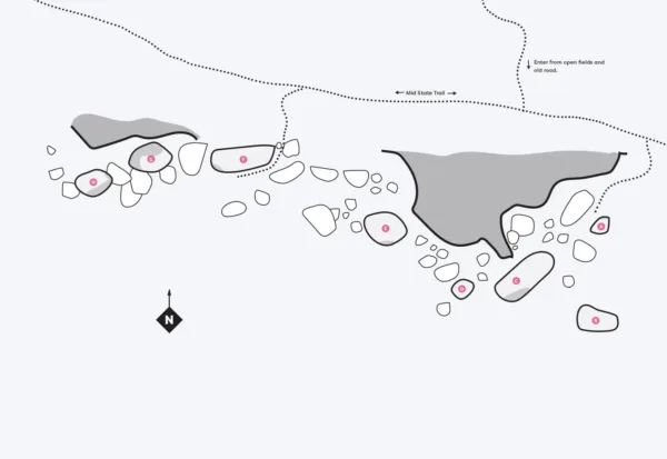
Micro Approach Beta
For best results utilize the Mid State Trail (orange blaze) to traverse the top of the boulderfield. Moving through the boulderfield can be slow due to talus and down trees. There are a few access points where the cliff line eases up to venture down to the boulders.